Retrieve gridded population data from the WorldPop API.
Select which data to download using
wp_categories,wp_projects, andwp_datasetsRetrieve metadata about datasets using
wp_metaDownload gridded data using
wp_data
Usage
wp_categories()

wp_projects(category = "pop")

wp_datasets(category = "pop", project = "wpic1km")

wp_meta(
  id = NULL,
  country = NULL,
  year = NULL,
  category = "pop",
  project = "wpic1km"
)

wp_data(
  country = NULL,
  year = "latest",
  id = NULL,
  category = "pop",
  project = "wpic1km",
  path = NULL
)
Arguments
- category
Alias of a dataset returned by
worldpop_datasets. Defaults to"pop"(population counts).- project
Alias of a dataset returned by
worldpop_projects. Defaults to"wpic1km"(unconstrained individual countries at a 1km resolution).- id
ID of a dataset as returned by
worldpop_levels. Can be used to identify a single dataset.- country
ISO-3 country code as returned by
worldpop_levels. Used to download the gridded data for a specific country.- year
Reference year of the requested population grid as returned by
worldpop_levels.- path
Path that the selected tif file should be downloaded to. If
NULL, the raster data is handled directly byrastand stored in a temporary directory.
Value
wp_categoriesandwp_projectsreturn dataframes of data categories and projects within these categories, respectively, including their names, descriptions, and aliases.wp_datasetsreturns a dataframe containing all datasets of a project including their IDs, titles, years and ISO-3 country codes.wp_metareturns a dataframe containing metadata about selected datasets.wp_dataeither returns a path (ifpathis provided) or an object of classSpatRastercontaining the exported data.
See also
ghsl_data for retrieving data from Global Human Settlement Layer
gisco_get_grid for retrieving data from Geostat
Examples
# inspect categories
wp_categories()
#> # A tibble: 18 × 4
#>    alias                name                          title                desc
#>    <chr>                <chr>                         <chr>                <chr>
#>  1 pop                  Population Counts             Population Counts    "<b>…
#>  2 births               Births                        Births               "The…
#>  3 pregnancies          Pregnancies                   Pregnancies          "The…
#>  4 urban_change         Urban change                  Urban change         "Eas…
#>  5 age_structures       Age and sex structures        Age and sex structu… "<b>…
#>  6 dahi                 Development Indicators        Development and Hea… "Imp…
#>  7 dependency_ratios    Dependency Ratios             Dependency Ratios    "The…
#>  8 internal_migration_f Migration Flows               Migration Flows      "Hum…
#>  9 dynamic_mapping      Dynamic Mapping               Dynamic Mapping      "Kno…
#> 10 global_flight_data   Global Flight Data            Global Flight Data   "The…
#> 11 covariates           Covariates                    Geospatial covariat… "<b>…
#> 12 gbsg                 Global Settlement Growth      Global Built-Settle… "Cha…
#> 13 gridcellsurfaceareas Grid-cell surface areas       Grid-cell surface a… "Gri…
#> 14 adminareas           Administrative Areas          Administrative Areas "Adm…
#> 15 pop_density          Population Density            Population Density   "<b>…
#> 16 pwd                  Population Weighted Density   Population Weighted… "<b>…
#> 17 future_pop           Future Population Projections Future Population P… "Thi…
#> 18 dug                  Degree of Urbanisation        Degree of Urbanisat… "The…

# inspect projects within the "pop" category
wp_projects("pop")
#> # A tibble: 17 × 2
#>    alias                 name
#>    <chr>                 <chr>
#>  1 "pic"                 "Individual countries"
#>  2 "pop_continent"       "Whole Continent"
#>  3 "wpgp"                "Unconstrained individual countries 2000-2020 ( 100m r…
#>  4 "wpgp1km"             "Unconstrained global mosaics 2000-2020 ( 1km resoluti…
#>  5 ""                    "WP00643"
#>  6 "wpgpunadj"           "Unconstrained individual countries 2000-2020 UN adjus…
#>  7 "wpic1km"             "Unconstrained individual countries 2000-2020  ( 1km r…
#>  8 "wpicuadj1km"         "Unconstrained individual countries 2000-2020 UN adjus…
#>  9 "cic2020_100m"        "Constrained Individual countries 2020 ( 100m resoluti…
#> 10 "cic2020_UNadj_100m"  "Constrained Individual countries 2020 UN adjusted  (1…
#> 11 "G2_UC_POP_2024_100m" "Unconstrained individual countries 2024 ( 100m resolu…
#> 12 "G2_CN_POP_2024_100m" "Constrained individual countries 2024 ( 100m resoluti…
#> 13 "G2_UC_POP_R24B_100m" "Unconstrained individual countries 2015-2030 ( 100m r…
#> 14 "G2_CN_POP_R24B_100m" "Constrained individual countries 2015-2030 ( 100m res…
#> 15 "G2_CN_POP_R25A_100m" "Individual countries 2015-2030 ( 100m resolution ) R2…
#> 16 "G2_CN_POP_R25A_1km"  "Individual countries 2015-2030 ( 1km resolution ) R20…
#> 17 "G2_MOS_POP_R25A_1km" "Global mosaics 2015-2030 ( 1km resolution ) R2025A v1"

# inspect datasets within the "wpic1km" project
wp_datasets("pop", project = "wpic1km")
#> # A tibble: 5,061 × 4
#>    id    title                                                 popyear iso3
#>    <chr> <chr>                                                 <chr>   <chr>
#>  1 29693 The spatial distribution of population in 2000 Russia 2000    RUS
#>  2 29694 The spatial distribution of population in 2001 Russia 2001    RUS
#>  3 29695 The spatial distribution of population in 2002 Russia 2002    RUS
#>  4 29696 The spatial distribution of population in 2003 Russia 2003    RUS
#>  5 29697 The spatial distribution of population in 2004 Russia 2004    RUS
#>  6 29698 The spatial distribution of population in 2005 Russia 2005    RUS
#>  7 29699 The spatial distribution of population in 2006 Russia 2006    RUS
#>  8 29700 The spatial distribution of population in 2007 Russia 2007    RUS
#>  9 29701 The spatial distribution of population in 2008 Russia 2008    RUS
#> 10 29702 The spatial distribution of population in 2009 Russia 2009    RUS
#> # ℹ 5,051 more rows

# retrieve metadata about the population grids in Samoa
wp_meta(country = "WSM")
#> # A tibble: 21 × 27
#>    id    title       desc  doi   date  popyear citation data_file archive public
#>    <chr> <chr>       <chr> <chr> <chr> <chr>   <chr>    <chr>     <chr>   <chr>
#>  1 34670 The spatia… Esti… 10.5… 2020… 2000    WorldPo… GIS/Popu… N       Y
#>  2 34671 The spatia… Esti… 10.5… 2020… 2001    WorldPo… GIS/Popu… N       Y
#>  3 34672 The spatia… Esti… 10.5… 2020… 2002    WorldPo… GIS/Popu… N       Y
#>  4 34673 The spatia… Esti… 10.5… 2020… 2003    WorldPo… GIS/Popu… N       Y
#>  5 34674 The spatia… Esti… 10.5… 2020… 2004    WorldPo… GIS/Popu… N       Y
#>  6 34675 The spatia… Esti… 10.5… 2020… 2005    WorldPo… GIS/Popu… N       Y
#>  7 34676 The spatia… Esti… 10.5… 2020… 2006    WorldPo… GIS/Popu… N       Y
#>  8 34677 The spatia… Esti… 10.5… 2020… 2007    WorldPo… GIS/Popu… N       Y
#>  9 34678 The spatia… Esti… 10.5… 2020… 2008    WorldPo… GIS/Popu… N       Y
#> 10 34679 The spatia… Esti… 10.5… 2020… 2009    WorldPo… GIS/Popu… N       Y
#> # ℹ 11 more rows
#> # ℹ 17 more variables: source <chr>, data_format <chr>, author_email <chr>,
#> #   author_name <chr>, maintainer_name <chr>, maintainer_email <chr>,
#> #   project <chr>, category <chr>, gtype <chr>, continent <chr>, country <chr>,
#> #   iso3 <chr>, files <list>, url_img <chr>, organisation <chr>, license <chr>,
#> #   url_summary <chr>

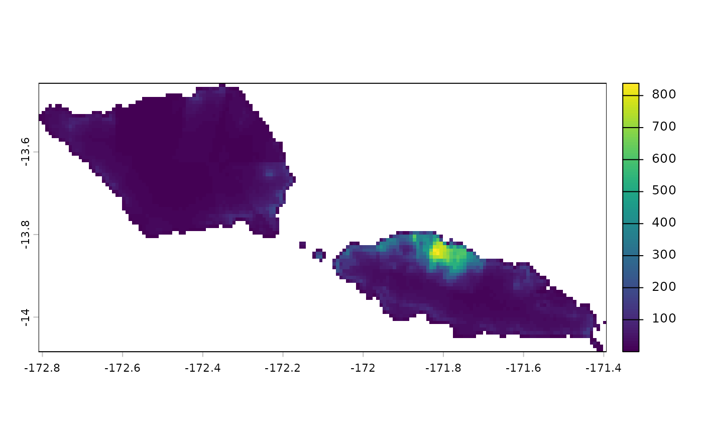
# download the population grid of Samoa in 2020
sam <- wp_data(country = "WSM", year = 2020)

library(terra)
plot(sam)