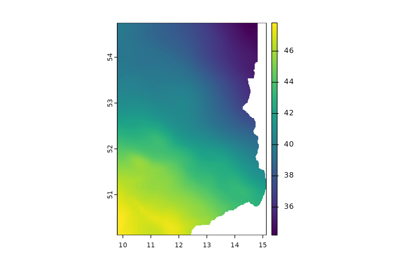
Retrieves the "German Combined Quasigeoid", the official height reference surface of the German land survey above the reference ellipsoid (GRS80).
A quasigeoid is an approximation of the geoid surface used to define normal heights above the earth's surface that is based on more practical assumptions than a true geoid. It defines heights in meters that can be more meaningful than ellipsoidal heights in many applications like surveying, hydrological modeling, engineering, or spatial analysis.
This function interfaces the quasigeoid product of the BKG.
Usage
bkg_quasigeoid(
  year = "latest",
  region = c("all", "coast", "no", "nw", "s", "w"),
  timeout = 120,
  update_cache = FALSE
)
Arguments
- year
Version year of the dataset. You can use
latestto retrieve the latest dataset version available on the BKG's geodata center. Older versions can be browsed using the archive.- region
Subterritory of Germany.
"all"returns the data for all of Germany,"coast"returns only coastal regions and"no","nw","s"and"w"refer to cardinal directions. Defaults to"all".- timeout
Timeout value for the data download passed to
req_timeout. Adjust this if your internet connection is slow or you are downloading larger datasets.- update_cache
By default, downloaded files are cached in the
tempdir()directory of R. When downloading the same data again, the data is not downloaded but instead taken from the cache. Sometimes this can be not the desired behavior. If you want to overwrite the cache, passTRUE. Defaults toFALSE, i.e. always adopt the cache if possible.
Value
A SpatRaster containing normal heights
for the specified region. The data comes in EPSG:4258 and a
resolution of 30" x 45" (approximately 0.9 x 0.9 km).