Retrieve geometries of INSPIRE-compliant grid geometries (also called
"GeoGitter"). bkg_grid_fast() is much faster than bkg_grid_full()
by downloading heavily compressed versions grids. This happens at the cost
of data richness as bkg_grid_fast() only contains the geometries and
nothing else. Note that the arrow package needs to be installed to
use bkg_grid_fast().
Note that the output contains point geometries. Most of the times, you
want to work with rasters instead. To convert a given object out,
type the following (terra package required):
terra::rast(out)These functions interface the GeoGitter product of the BKG.
Arguments
- year
Version of the grid. Can be
"2015","2017","2018"or"2019". Forbkg_grid_fast,"latest"downloads the latest version of the grid.- resolution
Cell size of the grid. Can be
"100m","250m","1km","5km","10km", or"100km".- timeout
Timeout value for the data download passed to
req_timeout. Adjust this if your internet connection is slow or you are downloading larger datasets.- update_cache
By default, downloaded files are cached in the
tempdir()directory of R. When downloading the same data again, the data is not downloaded but instead taken from the cache. Sometimes this can be not the desired behavior. If you want to overwrite the cache, passTRUE. Defaults toFALSE, i.e. always adopt the cache if possible.
Value
bkg_grid_fast returns an sf dataframe with point geometries
and no features. bkg_grid_full also returns point geometries but
with the following additional features:
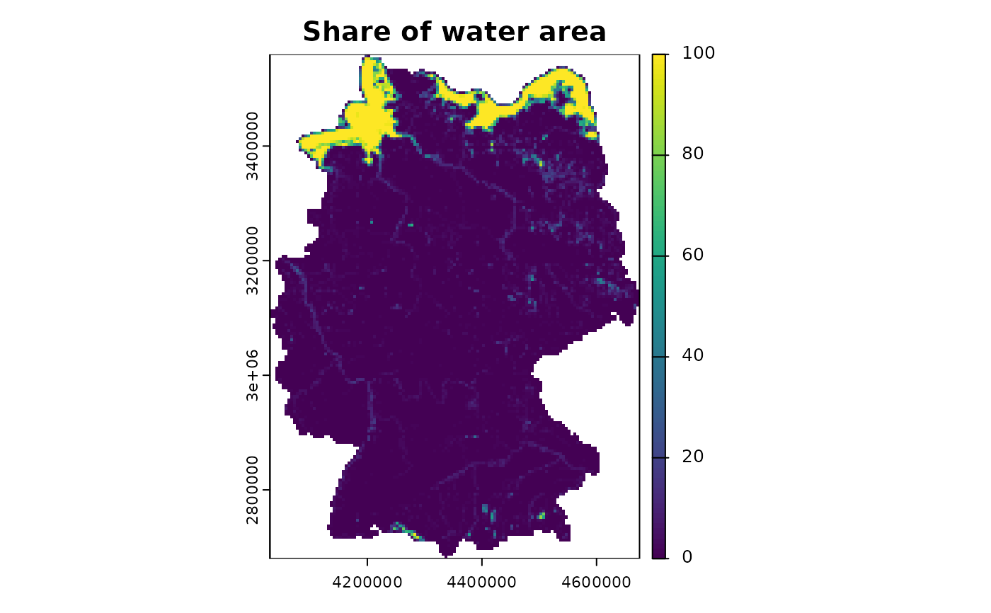
x_sw: X coordinate of the South-West corner of a grid celly_sw: Y coordinate of the South-West corner of a grid cellf_staat: State area in the grid cell in square metersf_land: Land area in the grid cell in square metersf_wasser: Water area in the grid cell in square metersp_staat: Share of state area in the grid cellp_land: Share of land area in the grid cellp_wasser: Share of water area in the grid cellags: Official municipality key (Amtlicher Gemeindeschlüssel). Related to the ARS but shortened to omit position 6 to 9. Structured as follows:Position 1-2: Federal state
Position 3: Government region
Position 4-5: District
Position 6-8: Municipality
Note that ags is only included for resolutions "100m" and
"250m"
Details
The following table gives a rough idea of how much less data
bkg_grid_fast needs to download for each resolution compared to
bkg_grid_full.
| Size | fast | full |
| 100km | 0.78 kB | 933 kB |
| 10km | 2.68 kB | 1,015 kB |
| 5km | 3.53 kB | 1,253 kB |
| 1km | 28.7 kB | 5,249 kB |
| 500m | 133 kB | 15,902 kB |
| 250m | 289 kB | 53,900 kB |
| 100m | 1,420 kB | 291,000 kB |
See also
Other non-administrative regions:
bkg_area_codes(),
bkg_authorities(),
bkg_kfz(),
bkg_ror()
Examples
# Return a bare-bones version of the INSPIRE grid
grid <- bkg_grid_fast(year = "2019", resolution = "100km")

# Return a fully detailed version instead
grid_full <- bkg_grid_full(resolution = "5km")

plot(grid)


# Convert grid to SpatRaster
if (requireNamespace("terra")) {
  library(terra)
  raster <- rast(vect(grid_full["p_wasser"]), type = "xyz")
  plot(raster, main = "Share of water area")
}
#> terra 1.8.93
# Convert grid to SpatRaster
if (requireNamespace("terra")) {
library(terra)
raster <- rast(vect(grid_full["p_wasser"]), type = "xyz")
plot(raster, main = "Share of water area")
}
#> terra 1.8.93